Roebourne and Point Sampson: Staircase to the moon, petroglyphs, very big trains, ships and wildflowers.
We might have to add to the name of this blog. Maybe it should be called TJ’s Sunday blog that seems to be the day that most of them get published.
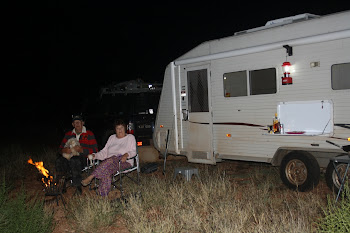
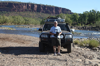
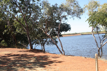
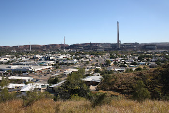
As I touched on in my last blog, we have settled in this area for a couple of weeks, firstly in Roebourne and now in Point Sampson, enjoying the warm weather (28 to 30 degrees each day) and the cool nights. It’s absolutely not the Gold Coast or Noosa or Broome and that’s what we like – a relaxed lifestyle in an excellent caravan park, nice neighbours, good weather, and plenty of great natural attractions to explore.
The Cove Caravan Park at Point Sampson is one of the best we’ve stayed in; we first stayed here three years ago. It’s architect designed with spacious sites, excellent landscaping, nice green lawns, a great camp kitchen, a rec room, a barbecue get-together area and well above-average facilities. It’s thankfully not like a Big 4 park with stuff we don’t use like a swimming pool, spa, jumping pillow etc. it’s just a nice comfortable park. We don’t make a practice of booking ahead but we do for this park. We like it here.
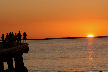
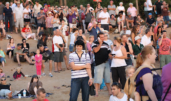
The staircase to the moon expedition was a laugh. I set up near the Cossack lookout, sitting in the prickly spinifex well away from a gaggle of young and old spectators who somehow thought they could take photos of the event on their fancy smart phones and on their digital cameras…..wrong. The only effect they had on my efforts was that their flashes kept going off as I was trying to do my time exposures. At least I managed to get a couple of reasonable shots between their flashes!
WARNING, the next section is a bit of a lecture on petroglyphs, with some editorial comment!
Karratha is about 40Km down the road from Roebourne and Dampier is another 20 Km or so further.
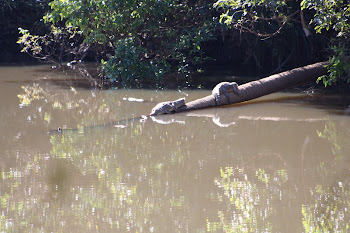
Just down the road from Karratha heading towards Dampier there is a turnoff to the Burrup Peninsular and then another turnoff to the right to Hearson Cove. Just before Hearson Cove there is a nondescript dirt track leading off the gravel. About 150 metres along the dirt track there are some small, old and faded signs indicating that there are some aboriginal engravings in the area. This is a slight understatement; experts believe there could be up to 1,000,000 engravings in the general area. The signs have been placed by the “Department of Aboriginal Sites”, more of them later.
I have done a little reading on these engravings, called petroglyphs and it makes an interesting story. The following stuff is largely plagiarised from “Making Their Mark: Pilbara rock art” by Roz Hagan taken from “Landscope” a publication by CALM WA from 2006
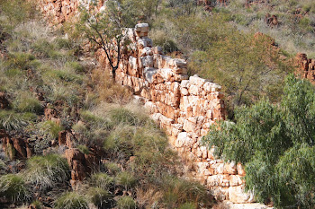
| The big piles of large irregularly shaped red rocks that hold the engravings are granophyre. According to Geoscience Australia, granophyre is defined thus “Granophyre, commonly porphyritic; remelted granite. Formerly referred to as "Dampier Granophyre". Intrudes along the basal unconformity of the Fortescue Group; intrudes the Hearson Monzogranite outcrops along the Burrup Peninsula and Dampier Archipelago islands. |
|
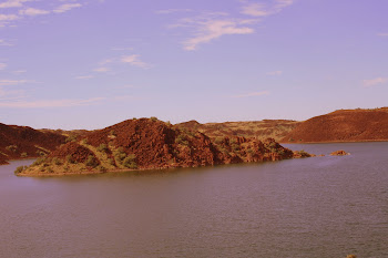
The areas of granophyre rock on which the local indigenous peoples, the Yaburara and possibly their close relations the Ngarluma engraved these petroglyphs look just like rubble piles left over from mining activity, but the stacks / piles are all naturally formed and similar piles exist right throughout the Pilbara.
The site was originally Dampier Island, part of the Dampier archipelago, named by the Yaburara peoples “Marujuga” meaning “hip bone sticking out”. It was not convenient to those developing the area for it to remain an island so, in the 1960’s, a causeway was built to give access to the area so an ore loading facility and a new town (Dampier) could be built.
The following are my thoughts only
I get the impression that the powers that be in this area are a little embarrassed at their past poor protection of the area and the removal of many of these petroglyphs; perhaps that’s why their presentation is still fairly low key these days. Here is my theory. The Department of Aboriginal Sites was probably put into place to ensure that Conservation and Land Management (CALM) or their predecessors were not able to protect the site from disturbance and development, so the ore loading facility and gas hub could be built, well, that’s my theory!
There are up to 1,000,000 (yes, that’s one million) petroglyphs and some are thought to be up to 18,000 years old. Many, of course, are very faded. Some engravings were noticed by those looking at the site as an ore loading facility in the 1960’s but luckily it was decided to build the facility at Dampier, a little further down the road.
The petroglyphs were also noticed by those charged with building the nearby North West Shelf gas processing facility in the 1980s but this time they actually moved some 1,800 of the engraved boulders and placed them in a compound near Hearson Cove, thus removing them from their historical context and restricting access to them. I guess that’s progress!! Clearly the area was not adequately be protected by the Department of Aboriginal Sites. End of my theory.
That was a pretty big call, considering the rocks themselves were probably formed between 2,500 and 3,600 million years ago when the earth’s crust was still very young. I understand that this area represents one of the world’s best preserved fragments of ancient continental crust – one of the earth’s earliest continents.
The petroglyphs served a variety of purposes for the Yaburara people. Some are believed part of “increase” sites for particular species or events. The indigenous people though that depicting animal and plant species in this way ensured their survival for the future and the continuity of the seasons. Other petroglyphs relate to ancestral creation beings, spirit figures, ceremonies and rites of passage.
It is true that the area had little significance to the local indigenous people after about 1868 but once again we see the hand of the whites involved. Around that time at least 60 of the Yaburara people were murdered on the islands in a series of raids over some days, raids that became known as the Flying Foam Massacre (the Flying Foam again!). Incidentally, the CALM document quoted extensively in this blog says that 26 Yaburara were massacred.
The ABC’s Four Corners said on 20th March 2000:
Title: SECRET WHITE MEN'S BUSINESS.
Stephen McDonnell (presenter)
This is a story with a deep history. It begins back in 1868 at this windswept place in the Pilbara. These standing stones were erected by Aborigines as a memorial to a massacre. Here two teams of white men slaughtered almost an entire tribe of Aborigines.
In a planned attack, at least 60 men, women and children from the Yaburara tribe were murdered in one day. The skulls of children with bullet holes in them were left behind.
The massacre is part of a colonial history in the West that saw thousands of Aborigines killed in a controlled and organised fashion.
These killings at the Burrup Peninsula became known as the Flying Foam Massacre: An act which completely destroyed a language, a culture, a people EXCERPT FROM 4 CORNERS CONCLUDES
Just Google ”The Flying Foam Massacre” for a number of different points of view.
The incident is known to have caused enormous losses to the Yaburara people and in the following period, the area containing the petroglyphs lay practically abandoned until the 1960’s when development began, as described above. It’s a sad story.
That’s enough history and serious stuff for one blog !!!
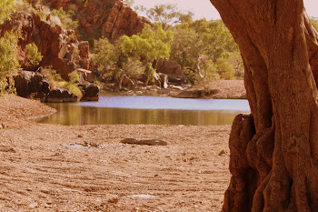
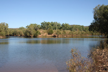
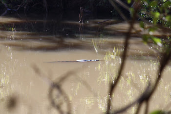
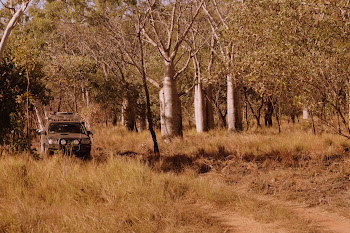
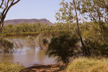
We took a trip to Harding Dam, the local water supply. It also has piles of rock similar to that described above and they also look like something left over from mining. There is no mention of petroglyphs there, well not so far anyway!
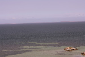
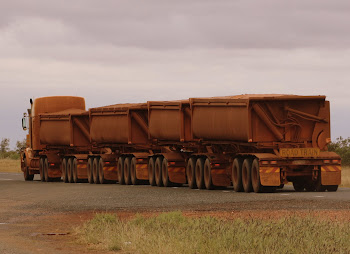
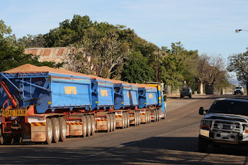
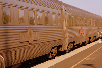
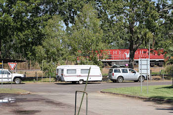
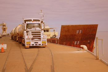
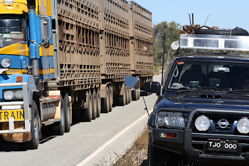
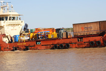
The name of the game in this area is, of course mining and the transport of the iron ore to an endless number of bulk carriers that assemble off the coast on a daily basis. The Pilbara railway is an impressive and very busy line carrying iron ore from the mine to the ship loading facilities, in this case Port Lambert, near Point Sampson and Dampier. The track to Harding Dam runs beside large sections of the railway and the huge ore trains are a wonderful sight, I love trains nearly as much as birds. One train heading back to the mine was hauling more than 320 empty trucks, marvellous to watch.
Parts of the railway we saw are dual track, no doubt a siding allowing trains to pass one another on their trips to and from the loader. Another train hauling ore to the loader was pulling 163 loaded trucks, no doubt quite a few dollars’ worth of ore for the ships to take away to China or Japan. As I write this, three or maybe four huge ships are being loaded at the nearby Port Lambert while six others are anchored a little out to sea awaiting their turn.
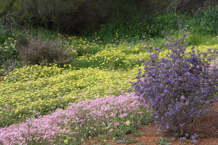
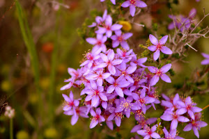
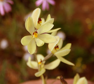
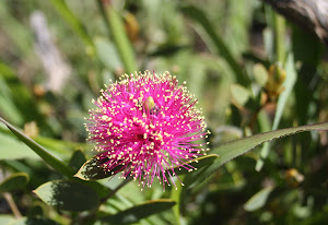
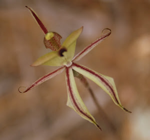
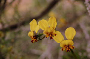
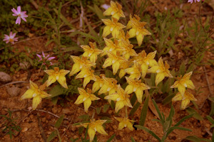
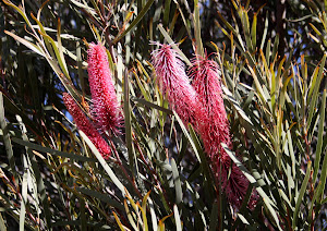
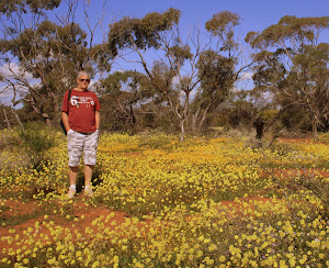
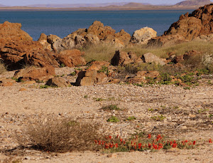
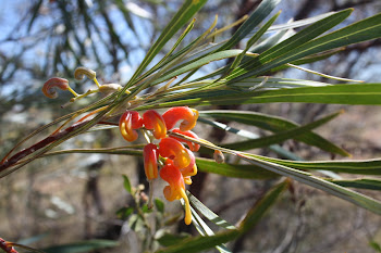
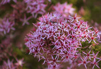
There’s no doubt that WA has the best displays of wildflowers. Even now, when the wildflower season is yet to start, there are masses of Sturt Desert Pea and large displays of Mulla Mulla in the areas surrounding Point Sampson. This year’s wildflower season is tipped to be one of the best for some time and we look forward to following some of the wildflower trails towards the south…. But not just yet, we’ll wait till it warms up a bit!
Next Stop Onslow and then we are going bush for a week.